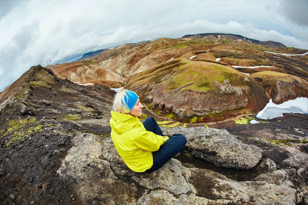
Planning a trip and looking for the best summer hikes in Iceland? From coastal walks to highland treks, Iceland offers some of the most diverse hiking experiences in Europe.
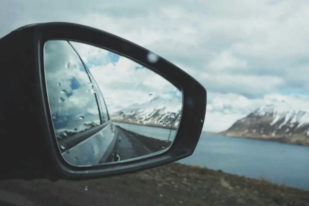
The best part? Many of these trails are easy to reach by car, making them perfect for a self-drive Iceland itinerary. Whether you’re renting a small car or a 4×4 rental in Iceland, these hikes are accessible, scenic, and worth adding to your road trip.
1. An Easy Coastal Hike in Snæfellsjökull National Park: Arnarstapi – Gatklettur – Hellnar
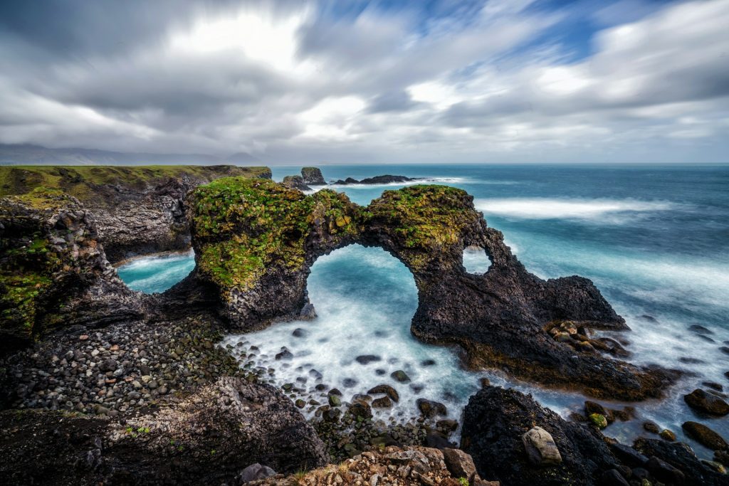
Located in Snæfellsjökull National Park, this is one of the easiest and most scenic coastal hikes in Iceland. The trail follows the shoreline between Arnarstapi and Hellnar, offering continuous views of basalt cliffs, open ocean, and rugged volcanic formations.
What makes this hike special is how quickly the landscape changes. You move from a small fishing village into a dramatic coastline shaped by lava and constant wave erosion. Gatklettur, the natural stone arch rising from the sea, is the main highlight, but the entire route is filled with smaller rock formations and viewpoints worth stopping for.
The trail is flat, well-marked, and suitable for most travelers, including families. During summer, seabirds such as Arctic terns nest along the cliffs, so it’s important to stay on marked paths. Ending in Hellnar, you can stop at the café and enjoy the quieter atmosphere before heading back. This is an ideal short hike if you’re exploring the Snæfellsnes Peninsula.
Trail Route Map
Trail Info
- Difficulty: Easy (1/5)
- Experience: Impressive (5/5)
- Path Conditions: Smooth until reaching the lava field, Good Signage
- Main Challenges: Slick conditions when wet, rocky terrain
- Maximum Ascent: 65 feet (20 meters)
- Distance: 4.3 miles (6.9 kilometers)
- Duration: 45 minutes
How to get there by car
Getting to Arnarstapi Trail from Reykjavik takes 2 hours and 35 minutes. You’ll cover 120 miles along Route 1 and Route 54 to get there (194 kilometers).
2. Best short hike inside Skaftafell Nature Reserve
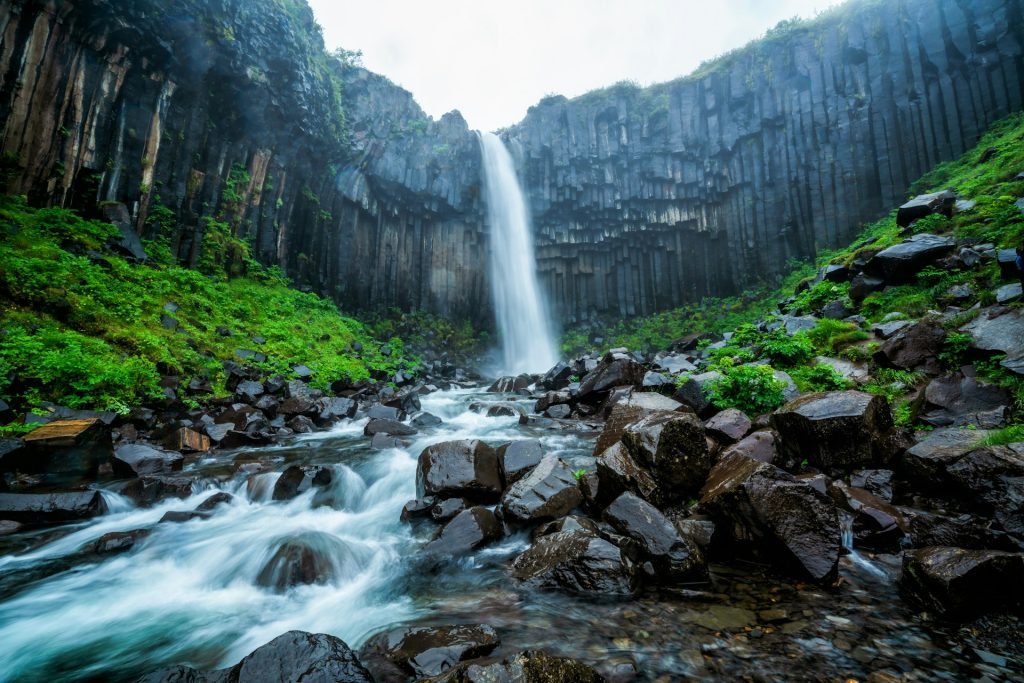
This hike in Skaftafell Nature Reserve, part of Vatnajökull National Park, offers one of the most complete hiking experiences in Iceland within a relatively short distance.
The trail begins at the visitor center and gradually climbs to Svartifoss, one of the most recognizable waterfalls in Iceland due to its surrounding basalt columns. This section can be busy, but continuing along the loop quickly brings quieter trails and more open scenery.
As you move further along, the landscape shifts from waterfalls and wooded areas to wide viewpoints overlooking the Vatnajökull glacier. The Sjónarnípa viewpoint is a standout, offering a clear view of the ice cap and glacial rivers below. The contrast between green valleys and the glacier gives a strong sense of Iceland’s “fire and ice” landscape.
While there are some steeper sections, the trail is well-marked and manageable for most hikers, making it one of the best short hikes along the South Coast.
Trail Route Map
Trail Info
- Difficulty: Moderate (3/5)
- Experience: Impressive (5/5)
- Path Conditions: Can be muddy after rain, Good Signage
- Main Challenges: Steep climbs and exposed sections of trail, can be crowded around Svartifoss as this is a very popular hike
- Maximum Ascent: 889 feet (271 meters)
- Distance: 4.6 miles (7.4 kilometers)
- Duration: About 2 hours and 15 minutes to complete the loop
How to get there by car
Getting to the Skaftafell Trail from Reykjavik takes 4 hours and 10 minutes. You’ll cover 203 miles (327 kilometers) along Route 1, also known as the Ring Road, to get there.
3. Best short hike to a natural hot spring: Hiking to Reykjadalur Hot River Valley
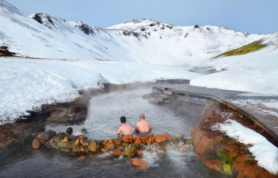
The hike to Reykjadalur Valley is one of the most popular day hikes near Reykjavík, combining scenic walking with a natural hot spring experience.
The trail starts with a steady uphill climb before opening into a geothermal valley filled with steam vents, rolling hills, and small waterfalls. As you continue, the landscape becomes more open and unique, shaped by active geothermal processes beneath the surface.
Along the way, you’ll pass bubbling ground and steaming vents, giving a clear sense of Iceland’s volcanic activity. The final destination is the hot river, where you can bathe in naturally heated water. The temperature varies depending on where you sit, so you can find a comfortable spot.
Wooden walkways and simple changing areas make access easier, but conditions can be muddy, especially after rain. This hike is a great combination of activity and relaxation, and one of the most accessible geothermal experiences in Iceland.
Trail Route Map
Reykjadalur Trail Info
- Difficulty: Moderate (3/5)
- Experience: Impressive (5/5)
- Path Conditions: Muddy when wet, Good signage
- Main Challenges: Paid parking, steep start to the trail
- *There are new changing areas!*
- Maximum Ascent: 1,269 feet (386 meters)
- Distance: 5.7 miles (9 kilometers)
- Duration: About 3 hours with time for soaking in the hot springs
How to get there by car
Getting to the Reykjadalur Trail from Reykjavik takes 48 minutes. You’ll cover 31 miles (50 kilometers) along Route 1, also known as the Ring Road, to get there.
4. Best hike to see Puffins: Látrabjarg Cliff trail
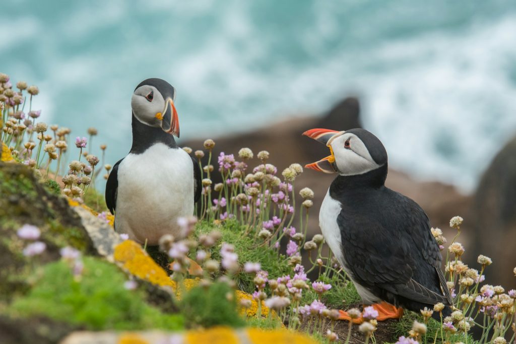
The Látrabjarg Cliffs offer one of the best places in Iceland to see puffins up close. The trail follows grassy paths along high sea cliffs, with wide views over the Atlantic Ocean.
This hike is less about distance and more about the experience. During summer, puffins nest along the cliff edges and can often be seen just a few meters away. The area is also home to other seabirds, making it an important bird-watching location.
The cliffs stretch for kilometers and are among the westernmost points in Europe, giving the area a remote and untouched feel. While the path itself is relatively easy, the main challenge is the exposed environment. Strong winds and unstable ground near the edges mean it’s important to stay on marked paths and keep a safe distance from the cliffs
Trail Route Map
Látrabjarg Trail Info
- Difficulty: Easy (1/5)
- Experience: Impressive (5/5)
- Path Conditions: Smooth terrain, Good signage
- Main Challenges: Exposed, sheer cliffs that are dangerous and high winds
- Maximum Ascent: 2,880 feet (877 meters)
- Distance: 4.5 miles (7.2 kilometers)
- Duration: About 4 hours
How to get there by car
Getting to the Latrabjarg Cliff Trail from Reykjavik takes 5 hours and 48 minutes. You’ll cover 258 miles (415 kilometers) along several different roads, including Route 1, to get there.
Vatnajökull National Park Hike to Skógafoss Waterfall Trail
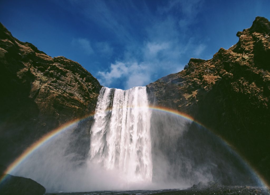
Starting at Skógafoss, this hike follows the Skógá River and offers one of the most scenic waterfall routes in Iceland.
The climb beside Skógafoss is steep but short, and once at the top, the trail opens into a longer route with multiple waterfalls along the river. As you continue, each section reveals new viewpoints, smaller cascades, and a quieter atmosphere away from the main tourist area.
This trail forms part of the Fimmvörðuháls Trail, which continues into the highlands. However, you don’t need to complete the full hike to enjoy it. Many visitors choose to walk a shorter section and turn back, making it flexible depending on time and energy.
The mix of easy access at the start and more remote scenery further along makes this one of the most rewarding hikes on the South Coast.
Trail Route Map
Trail Info
- Difficulty: Moderate (3/5)
- Experience: Awe-inspiring (5/5)
- Path Conditions: Well-maintained with good signage, though can be slippery near the waterfall.
- Main Challenges: Steep inclines, particularly the climb next to Skógafoss, and potentially muddy conditions.
- Maximum Ascent: Approximately 500 meters (1,640 feet)
- Distance: 16 kilometers (10 miles) round trip
- Duration: 4 to 6 hours
How to Get There by Car: From Reykjavik, take Route 1 southeast for about 2 hours (155 kilometers) until you reach Route 249. Turn onto Route 249 towards Skógar, where ample parking is available near the waterfall.
Additional Information: Vatnajökull National Park, the largest national park in Europe, is home to a diverse array of landscapes, from towering glaciers to expansive volcanic deserts. The hike to Skógafoss is particularly notable for its rich history and geological features.
The trail follows the Skógá River, which originates from the Eyjafjallajökull and Mýrdalsjökull glaciers, passing 26 other stunning waterfalls. This hike is part of the larger Fimmvörðuháls trail, which extends into the highlands, offering adventurous hikers the opportunity to explore even more remote and beautiful parts of Iceland.
The Skógafoss area itself is steeped in local folklore, with legends of hidden treasures buried by the first Viking settlers, adding an element of mystery and intrigue to your hike.
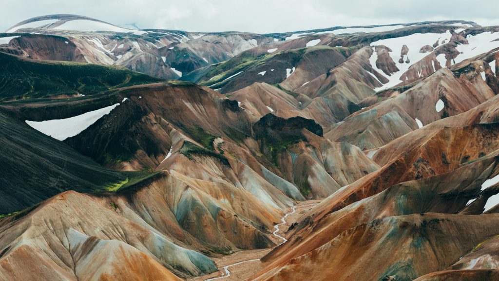
6. Laugavegur Trail: Iceland’s Premier Long-Distance Hike
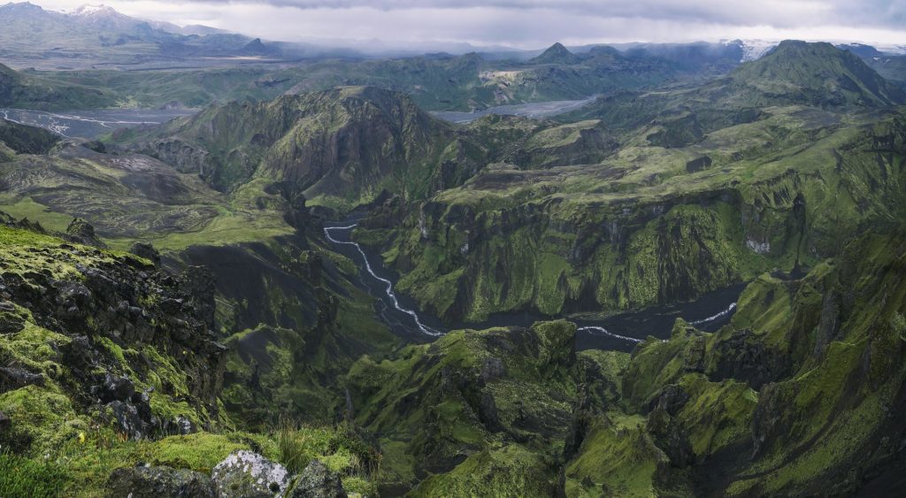
The Laugavegur Trail is Iceland’s most famous multi-day hike, known for its constantly changing landscapes and remote highland setting.
Starting in Landmannalaugar, the trail passes through colourful rhyolite mountains, lava fields, black sand deserts, and green valleys before reaching Þórsmörk. Each section feels completely different, which is what makes this trail stand out compared to shorter hikes.
The route includes river crossings, elevation changes, and exposed terrain, requiring preparation and awareness of weather conditions. While the trail is well-marked, it is more demanding and typically takes several days to complete.
Access to the starting point involves highland roads, meaning a 4×4 vehicle is required if you are driving yourself. For those prepared, this hike offers one of the most complete and memorable experiences in Iceland
Trail Route Map
Trail Info:
- Difficulty: Challenging (4/5)
- Experience: Spectacular (5/5)
- Path Conditions: The trail is well-marked but includes rough and varied terrain. Weather conditions can change rapidly.
- Main Challenges: The trail features significant elevation changes and potentially harsh weather conditions. River crossings and steep ascents are part of the challenge.
- Maximum Ascent: Around 500 meters (1,640 feet)
- Distance: 55 kilometers (34 miles)
- Duration: Typically takes 3 to 4 days to complete, depending on pace and weather.
How to Get There by Car: To reach Landmannalaugar from Reykjavik, drive via Route 1 towards the town of Hella. From Hella, take Route 26 and then Route F208, following signs to Landmannalaugar. The drive is approximately 3 to 4 hours (around 180 kilometers). Note that the final stretch involves highland roads, which may require a 4×4 vehicle.
How to pack and prepare for the hikes?
Preparing for a hike in Iceland involves careful planning and packing to ensure a safe and enjoyable experience. The country’s unique and unpredictable weather conditions, combined with its diverse terrain, require hikers to be well-prepared. Here are some detailed tips and information on how to pack and prepare for the best hikes in Iceland:
Weather Check
- Monitor the Weather: Always check the Icelandic MET Office website for accurate and up-to-date weather conditions. Iceland’s weather can change rapidly, even in summer, and being aware of the forecast is crucial for planning your hike.
- Local Updates: Pay attention to local weather advisories and road conditions. Websites like SafeTravel Iceland provide important safety information and travel alerts.
Clothing and Gear
- Layering System: Dress in layers to adapt to changing weather conditions. Start with a moisture-wicking base layer, add an insulating layer (like fleece or down), and top it off with a waterproof and windproof outer layer.
- Warm Accessories: Even in summer, temperatures can dip below freezing. Pack a winter hat, gloves, and a scarf to keep warm.
- Sturdy Footwear: Hiking boots are essential for Iceland’s often slippery and uneven trails. Ensure your boots are waterproof and well-broken-in to avoid blisters.
- Socks and Gaiters: Wear moisture-wicking hiking socks and consider gaiters to keep your feet dry and protect them from debris.
- Rain Gear: A good quality rain jacket and rain pants are indispensable, as Icelandic weather can be very wet.
- Sunglasses and Sunscreen: The summer sun can be intense despite mild temperatures. Protect your eyes with UV-blocking sunglasses and your skin with a high-SPF sunscreen.
Essentials for the Hike
- Backpack: A sturdy, comfortable backpack is necessary to carry your gear. Look for one with a rain cover and multiple compartments for organization.
- Water and Hydration: Bring plenty of water, and consider a hydration system for easy access. Icelandic water is very clean, so you can refill from streams in many areas.
- Food and Snacks: Pack high-energy snacks like nuts, dried fruit, and energy bars. For longer hikes, bring a packed lunch.
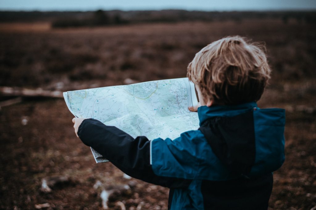
- Navigation Tools: Carry a map, compass, and/or GPS device. While many trails are well-marked, having these tools can help if you stray off the path or need to navigate in poor visibility.
- Safety Gear: A first aid kit, whistle, and emergency blanket are crucial for unexpected situations. Consider bringing a multi-tool or knife as well.
- Mobile Phone: Ensure your phone is fully charged and consider carrying a portable charger. Having a phone is important for emergency communication.
Safety Precautions
- Inform Others: Always inform someone about your hiking plans, including your route and expected return time. This is vital in case of emergencies.
- Stay on Trails: Stick to marked trails to protect the environment and for your safety. Off-trail hiking can be dangerous due to unstable terrain and hidden hazards.
- Check Local Advice: Some areas may have specific safety advisories or restrictions, especially in more remote or ecologically sensitive regions. Check with local visitor centers or park rangers.
Additional Tips
- Acclimate to Conditions: Spend some time getting used to the local weather and terrain before embarking on longer hikes. Shorter hikes can help you acclimate.
- Respect Nature: Iceland’s landscapes are fragile. Follow Leave No Trace principles: pack out all trash, avoid disturbing wildlife, and respect plant life.
- Prepare for Emergencies: Know basic first aid and how to handle common hiking injuries. Familiarize yourself with emergency procedures and local emergency numbers.
Tips for getting ready for a trip to Iceland in summer
● Book Early – Making sure to book your summer vacation in Iceland early is one of the most important tips! You’ll need to book rental cars, accommodation, and activities at least 3 months in advance to ensure that you get what you’re looking for.
● Be Prepared for Bad Weather – Bad weather can strike Iceland at any time of year. While it might not be snowing or icing, temperatures can quickly turn chilly and even freeze at higher elevations. Rain is also common in Iceland in the summer months. Be sure to check the weather before you head out!
● Plan in Advance – Because you’ll be booking your trip early, you should also start planning early. Some areas of Iceland are only accessible during the summer months like the rugged interior highlands, Landmannalaugar and Iceland’s many mountains! Check our guides to Iceland in July and Iceland in August to prepare for what to expect.
FAQ: Hiking in Iceland
- What is the best time to go hiking in Iceland?
The best time for hiking in Iceland is from June to August, when trails are clear, daylight hours are long, and most regions, including the highlands, are accessible.
- Do I need a 4×4 rental car for hiking in Iceland?
It depends on where you’re going.
- 2WD cars are enough for popular areas like the South Coast, Golden Circle, and Snæfellsnes Peninsula
- 4×4 vehicles are required for highland areas and F-roads, including access to places like Landmannalaugar
- Are hiking trails in Iceland safe?
Most hiking trails in Iceland are safe and well-marked, but conditions can change quickly. Always:
- Check weather forecasts on Icelandic Meteorological Office
- Stay on marked paths
- Be cautious near cliffs, rivers, and geothermal areas
- Can beginners go hiking in Iceland?
Yes, Iceland has many beginner-friendly hikes such as Arnarstapi and Reykjadalur. These trails are relatively easy, well-marked, and suitable for most fitness levels.
- What should I wear for hiking in Iceland in summer?
Even in summer, weather can change quickly. It’s best to wear:
- A waterproof jacked and pants
- Layered clothing (base layer + insulation)
- Sturdy hiking boots
- Can you hike to hot springs in Iceland?
Yes, one of the most popular hikes is to Reykjadalur Valley, where you can bathe in a natural hot river after the hike.
- Is it safe to hike alone in Iceland?
Hiking alone is generally safe, but you should always:
- Inform someone of your plans
- Carry a fully charged phone
- Avoid remote trails without preparation
- Do I need to plan hikes in advance in Iceland?
Yes, especially in summer. Popular areas can get busy, and accommodation, rental cars and parking can fill up quickly. Planning ahead helps you make the most of your trip.
Conclusion
Summer is the best time for hiking in Iceland, with long daylight hours, accessible trails, and more stable weather conditions across the country. From easy coastal walks to multi-day highland treks, there’s a wide range of hikes to suit every type of traveler.
Planning your route in advance makes a big difference, especially if you want to combine multiple hikes into one trip. Exploring by car gives you the flexibility to reach different regions, stop along the way, and adjust your plans depending on the weather.
If you’re getting ready for your trip, Firefly Iceland Car Rental offers cheap options to help you explore more of the country, especially if you’re planning to visit multiple hiking regions in one trip.
Share this guide with your travel companions and start planning your Iceland adventure together.